Books by Will Kennedy
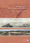
Stephan G. Schmid & Will M. Kennedy (eds.), The Topography of Ancient Idalion and its Territory (Berlin 2024), 2024
The question of how to define the territories of the ancient polities (city-kingdoms) of Iron Age... more The question of how to define the territories of the ancient polities (city-kingdoms) of Iron Age Cyprus is a fascinating, but also a very difficult one. While this topic has already been widely explored by previous scholarship, recent investigations that include both modern approaches, such as the application of landscape archaeological methodologies, as well as a re-evaluation of the available archaeological evidence from a new perspective, now offers a fresh take on such questions. A workshop organized in Berlin in 2018 aimed at discussing additional information on the topography of the ancient city of Idalion and its hinterland. This volume therefore includes unique contributions that deal with a wide array of relevant aspects. They provide new information on the location, chronology and character of settlements, necropoleis and sanctuaries from the wider area of Idalion, and discuss important issues such as the continuity or discontinuity of settlement activities from the (Late) Bronze Age to the Iron Age and how this is reflected by material culture. They address questions concerned with the physical control of territories and communication networks by considering Idalion’s resource availability and the overall development of its rural settlement pattern in contrast to that of its neighbouring polities.
Papers and Book Chapters by Will Kennedy
W. M. Kennedy, Embedding spatial analyses in culture-historical discourse. Experiences from Jorda... more W. M. Kennedy, Embedding spatial analyses in culture-historical discourse. Experiences from Jordan and Cyprus, in: V. Evangelidis, D. Tsiafaki, Y. Mourthos, M. Karta, (eds), Mapping the Past, Plotting the Future: GIS in Archaeology, Maturity and Implementation. Proceedings of the workshop organised by the AeGIS Athena Lab, at the British School at Athens, Thursday 30 March 2023. Journal of Greek Archaeology 9, 2024, 123–140
Defining the Rural Environs of Ancient Idalion: A Fuzzy Landscape Archaeological Approach for Determining Idalion's Resource Potential, 2024
Following the principles of fuzzy logic, this paper aims at presenting preliminary results of a f... more Following the principles of fuzzy logic, this paper aims at presenting preliminary results of a fuzzy model of the resource potential of Cyprus that takes the island’s rich copper resources, land and river routes, access to the coast, the availability of timber as well as the hydrological and agricultural potential into account.
With a specific focus on the Iron Age polity of ancient Idalion, it then attempts to determine the 'city-kingdom’s' possible spatial extent by assessing the maximum resource potential of Idalion’s immediate surroundings.
Recent research within the urban limits of Nabataean Petra has identified different social groups... more Recent research within the urban limits of Nabataean Petra has identified different social groups that were organized within spatially defined social 'districts.' Together with other archaeological evidence from within the city, this suggests a clear stratification of the cityscape into distinct social spaces. The evidence from Petra clearly highlights a Nabataean social structure that was deeply rooted in family, clan or tribal traditions, which can be traced back to the nomadic origins of the Nabataeans. While this correlates well with the evidence in urban Petra, the socio-political organization of Petra's hinterland remains largely unknown. This paper therefore aims at offering additional insights into rural Petra's socio-political make-up by presenting selected archaeological sites that were identified as possible markers of distinct social landscapes in Petra's surroundings. Specifically, this contribution focuses on presumed rural Nabataean mansions. This paper examines how these structures might reflect new perspectives on the social stratification outside Petra's city center in Nabataean-Roman times and argues that such sites contribute to our understanding of the complex social structure of Petra's hinterland, which can be characterized as an intricate patchwork of various social groups as is assumed for urban Petra.

Lay-out & cover design: Sidestone Press Photograph cover: Peter Akkermans -Jebel Qurma Archaeolog... more Lay-out & cover design: Sidestone Press Photograph cover: Peter Akkermans -Jebel Qurma Archaeological Landscape Project ISBN 978-90-8890-942-9 (softcover) ISBN 978-90-8890-943-6 (hardcover) ISBN 978-90-8890-944-3 (PDF e-book) The Late Chalcolithic and Early Bronze Age of the badia and 165 beyond: implications of the results of the first season of the 'Western Harra Survey' Abstract While it may be misconceived that the Nabataeans followed a linear development from a 'primitive', non-sedentary nomadic origin to a more culturally enriched and sedentary lifestyle, recent historical and material evidence challenges this rather simplistic view of cultural evolution. Archaeological research clearly suggests that Nabataean culture was particularly complex and distinctly characterised by an amalgamation of both Hellenised and Oriental, mobile and sedentary, material culture. The evidence, however, is mostly limited within urban boundaries, particularly those of Petra. The question therefore arises whether the archaeological evidence in Petra's rural hinterland allows similar assumptions. Numerous surveys have been carried out in the immediate environment of the Nabataean capital, documenting various archaeological sites ranging from the Iron Age to the Byzantine and Early Islamic periods. Previous works have also discussed rural settlements and land use strategies in the Petra region, laying the focus outside Petra's city limits. Although these studies are immensely important for the understanding of rural Petra, they strongly focus on sedentary rural settlements, thus falling short of an overall and in-depth contextualisation of the various other archaeological sites and features
Journal of Roman Archaeology, 2017
Numerous archaeological surveys have already contributed to the research of the surroundings of t... more Numerous archaeological surveys have already contributed to the research of the surroundings of the ancient Nabataean capital Petra (Jordan). The provided dataset forms the basis for further studies on the landscape organization of the Petraean hinterland. However, a reevaluation of the data revealed, in some cases, greatly differing and inconsistently defined chronological specifications of archaeological sites. Researching the general landscape organization of spatial strategies in the Petraean hinterland throughout time, such fundamental inconsistencies within the core archaeological dataset is a very critical methodological issue that needs to be addressed before following up larger research questions. This contribution therefore quantifies such uncertain chronological information and aims at offering definitions of the evidenced cultural periods that make the chronological uncertainties inherent to the base dataset transparent for future research. Petra hinterland; chronology; chronological uncertainty; dating probability; archaeological surveys.
Bibliographische Information der Deutschen Nationalbibliothek Die Deutsche Nationalbibliothek ver... more Bibliographische Information der Deutschen Nationalbibliothek Die Deutsche Nationalbibliothek verzeichnet diese Publikation in der Deutschen Nationalbibliografie; detaillierte bibliographische Daten sind im Internet über http://dnb.d-nb.de abrubar.
Project Reports by Will Kennedy
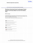
Recent research within the urban limits of Nabataean Petra, Jordan, has identified different soci... more Recent research within the urban limits of Nabataean Petra, Jordan, has identified different social groups that were organised within spatially defined social 'districts' (cf. Nehmé 2013). The evidence from Petra clearly highlights a Nabataean social structure that was deeply rooted in family, clan, or tribal traditions, which can be traced back to the nomadic origins of the Nabataeans (cf. Schmid 2013 and 2021). While such sociopolitical aspects of Nabataean culture have already been extensively explored in urban Petra, investigations of similar aspects in Petra's hinterland are only beginning to gain scholarly attention. As part of a more comprehensive archaeological study (Kennedy 2021), important archaeological sites were identified in the Petraean hinterland as possible archaeological markers of distinct social landscapes in Petra's surroundings. These include specific cultic sites such as rural sanctuaries or isolated cultic installations, funerary monuments as well as possible rural Nabataean mansions (Kennedy 2021, 487-98; 516-20). Arguably, such sites highlight the complex social structure of Petra's hinterland, which can be characterised as an intricate patchwork of various social groups as is assumed for urban Petra. However, the identification and analysis of these sites has so far been based almost entirely on very preliminary survey results. Therefore, the Petra Hinterland Social Landscapes Project (PHSLP) seeks to correct the record by providing detailed archaeological data of selected hinterland sites through historical and archaeological work. Overall, the PHSLP aims at revising our understanding of the socio-political makeup of Petra's hinterland. In order to achieve these very general project aims, the first site of these presumed archaeological markers that was investigated during the first project season in 2022 is known locally as Sahir al-Begh'er, located immediately west of the Nabataean-Roman settlement of Ras Slaysil, situated c. 6 km northwest of Petra (Figure 1). Among other monumental structures, Ras Slaysil features a small, open-air sanctuary (known as ad-Dahune Slaysil) built on a rugged cliff of volcanic stone that overlooks an extremely steep, 450 m drop towards the Wadi Arabah in the west (Lindner 2003, 168-69; Alcock and Knodell 2012; Lindner and Gunsam 1995a, 268-69). After a difficult descent from the sanctuary along ancient pathways (Figure 2), the monumental Nabataean structure known locally as Sahir al-Begh'er lies at the very bottom (Figures 3 and 4).
ATLAL - the Journal of Saudi Arabian Archaeology, 2020
Science and Public Outreach by Will Kennedy
Alle Rechte vorbehalten, insbesondere das Recht der Übersetzung in fremde Sprachen. Ohne ausdrück... more Alle Rechte vorbehalten, insbesondere das Recht der Übersetzung in fremde Sprachen. Ohne ausdrückliche Genehmigung ist es auch nicht gestattet, dieses Dokument oder Teile daraus auf fotomechanischem Wege (Fotokopie, Mikrokopie) zu vervielfältigen oder unter Verwendung elektronischer Systeme zu verarbeiten und zu verbreiten. Bildrechte können nach Rücksprache erteilt werden. Διατηρούνται όλα τα νόμιμα δικαιώματα, και ιδιαιτέρως τα δικαιώματα της μετάφρασης σε ξένες γλώσσες. Επιτρέπεται η αναπαραγωγή ή αναδημοσίευση του παρόντος έργου, αποσπασματικά ή στο σύνολό του, με οποιοδήποτε μέσο, ηλεκτρονικό ή μηχανικό, μόνο με προηγούμενη έγγραφη άδεια του εκδότη. Δικαιώματα εικόνων μπορούν να δοθούν κατόπιν συνεννόησης.
Papers by Will Kennedy
Lidar-Based Research in the Phokian Kephissos valley
Journal of Greek Archaeology 10, 2025, 20–33

Uploads
Books by Will Kennedy
Papers and Book Chapters by Will Kennedy
With a specific focus on the Iron Age polity of ancient Idalion, it then attempts to determine the 'city-kingdom’s' possible spatial extent by assessing the maximum resource potential of Idalion’s immediate surroundings.
Project Reports by Will Kennedy
Science and Public Outreach by Will Kennedy
Papers by Will Kennedy